
Flight into IMC
After my cross country flight, I remarked to Andy that I'd like to get some actual in before my instrument checkride. God must have been listening too, because the day of my next flight, Feburary 14th (I took my wife out the night before!) it was solid overcast most of the day.
1568R was available again, having had its attitude indicator replaced a few days beforehand. I noted a discrepancy between the tach/hobbs time indicated and what was in the computer, evidently I was the first one to fly the airplane after the work. So I was going to get to be the guinea pig to see if the AI actually worked properly for more than a 5 minute check on the ramp. Yipee.
The plan was to fly to Centre, Alabama (C22) to fly the full VOR/DME arc to RWY 27, do the VOR or ILS into Rome, then come back and do the localizer or GPS into Cobb County. Of course, like most things in flying, what you plan to do and what actually happens usually diverge from each other. Observed weather at Cobb County at time of departure was 4 mile visibility and an overcast celiing at 600 feet and a 5-6kt wind from the northwest. Temps were high enough at all planned altitudes where icing shouldn't be of any concern.
I got my flight plan filed, pre-flighted the airplane, layed out my approach plates, called for my clearance, dialed my flight plan into the GPS, taxi'd down to 27, did the run-up, checked my instruments, and away we went. About a mile off the departure end of 27 I started poking my head into the cloud deck, and about 650' AGL, I went to zero/zero. For the first time in a long time, I was flying in actual instrument conditons. I knew flying in the clouds added some bumps to the situation, but I had forgotten how much it did. It wasn't too bad, but it required a little more vigalence on my part to keep the airplane pointed in the right direction and to maintain my assigned altitudes. I think a combination of that, and getting a little fixated on the attitude indicator, led me to being behind the airplane for the first half of the flight.
My first issue came up when we stated our intentions to Atlanta Approach. The controller got a little perturbed that I didn't file to the IAF for the first approach I wanted. Actually I started to, but then Andy said we could just request the approach in the air, since we were likely to get cleared straight to the airport as soon as we were airborne anyway, as C22 is just barely 50 miles away from Cobb County. So he goes and calls the center, and comes back to tell us to fly direct to the IAF for the VOR/DME arc, then hands me off to to center.
While all this is going on, I climb through 5000' or so, and break out of the cloud tops. It is an absolutely amazing and beautiful sight. Approach asks me what the weather is like up there, to which I reply, "It is clear as far as I can see, what clouds are above me are higher than I can climb to!", which gets a little chuckle from the controller.
When I called Atlanta Center, they threw a wrench into the entire plan for the day. Evidently I wasn't the only one who thought this would be a good day for some practice in IMC and there were no less than 3(!) aircraft shooting approaches into Rome and Cartersville. The traffic into Cartersville isn't the problem so much as the guy at Rome. All of the approaches into Rome use the Rome VOR for an IAF and/or missed approach hold, as does the approach I want to fly to C22. I ask for a hold to wait for the guy flying the ILS to Rome to get out of the way, but Center replies there's already one right on top of the VOR right behind the guy doing the ILS. So he can't (or won't) hold us there. Instead, he just tells us to fly direct to C22 and he'll turn us back towards the VOR when he can. So much for doing the DME arc. This goes on for about another 10 minutes, the 2nd guy goes missed at Rome and heads off to Cartersville to shoot another approach there. Luckily the 3rd airplane going into Cartersville had already cleared out of the way by the time all this was going on, otherwise it would have been a real zoo.
After all this, I finally get cleared back to the Rome VOR, and then cleared for the VOR/DME approach to C22. I start my descent to 4000', and since there's no charted procedure turn or hold-in-lieu, I fly over the VOR, give myself about 30 seconds, and do a standard rate turn to the left to intercept the inbound heading. Opposed to loading the approach in the GPS, Andy had me keep Rome VOR as my direct to waypoint so I'd have distance information and then fly the approach using the CDI tuned into the VOR. At the first intermediate fix, CAVIN, I start down to 2200', and a few minutes later the clouds start to break up. By the time I reach the FAF, there are large gaps and the ground is pretty much in plain sight. Being mindful to continue to fly the approach, particularly since there are still clouds below me, I continue on down to the MDA, passing through a few smaller clouds on the way down. I reach MDA about a mile and a half away from the missed point, and start looking around. I wasn't maybe a dot off on the CDI, but I can't find the airport. Andy tells me to look to my 1:30-2 o'clock and there it is. He remarks to me, "some of these VOR approaches give special meaning to the term 'non-precision approach'". Even though I was well within the tolerances of the approach, at 25 miles from the VOR, even that relatively small error off the radial puts you about 1/4 mile or more to the south of the runway. I turn towards the airport and at the MAP I go missed.
Climbing up to the missed approach altitude (4000') I intercept the 270 radial (flying 090 to, of course) from Rome and start trying to call the Center. I get within a few miles of the holding point before I finally establish contact with them and get IDd on RADAR. If I had not been able to contact the Center before that point, I would have had to have entered the hold. Instead I'm cleared to climb to 5000' but even though I'm out of the clouds at that altitude, it is just barely so. I'm still getting bumped around a little, so I request to go up to 7000' to find some smoother air. A handoff back to Atlanta Center got me a clearance direct to EKACU, the IAF for the north leg of the GPS 27 back to Cobb County. There's not much to flying a GPS approach (in my opinion) as long as you hold altitude, and it was rather satisfying to break out of the overcast at about 800' and have the runway directly ahead of you, right on the LPV "glide slope".
It was kind of a so-so flight. I executed the approaches well, but I was struggling a bit with the airplane, which I attribute to a breakdown in my instrument scan. Also, due to all of the confusion with ATC, I lost my mental picture of where I was and what I needed to do for a moment, which put me a little behind the curve. Add in a little vertigo, and I just didn't have the best feeling about my performance for that lesson. At least later on I found out part of the difficulty I had in maintaining heading was that the airplane was, in fact, pulling to the right because someone had (probably accidentally) tweaked one of the trim tabs on an alieron, after someone complained about it pulling right on an instrument checkride a couple of days later.
Andy's main take-away for me was that I needed to improve my cockpit organization a little bit, in regards to checklist items. On our initial climb-out, I left the fuel pump running, along with the landing light. While neither item affects the performance of the flight, keeping on top of the checklist is something that the examiners definitely look for. Despite that, he said I still flew relatively well, he noted that I was little off compared to the past couple of flights, but wasn't too concerned about it. He scheduled me for my stage check flight with one of the other Senior CFIIs there the following weekend, but I had to scrub that because of gusty winds and this upcoming Sunday isn't looking too good either for the same reason.
In the meantime, I'm going to get my written out of the way, and just continue to practice on Flight Sim at home, paying particular attention to my scan and practicing holds, approaches, timed turns, etc.
Instrument Cross Country
After two postponements, I finally finished my instrument cross country on Feb 6th. Compared to the two days I had scheduled before, the weather was near perfect for the flight. Not a cloud in sight and the ride was smooth along almost the entire route of flight.
I was supposed to have flown 1568R, but the attitude indicator failed (with a loud crunch, so I'm told) the day before and would not be available, unless I felt like staying local and VFR to practice some partial panel. Having scrubbed this flight a couple of times already, I decided against it and got moved over to N53361, a Cessna 172P. It had a similar avionics package to the Tiger so all I was really giving up was a few knots of speed. Incidentally, this was also the 20th aircraft I logged time in since starting my flying hobby over 8 years ago.
My plan was to fly from Cobb County to Birmingham Intl. (KBHM), perform an ILS approach there, then to Auburn, AL (KAUO), for the VOR/DME-A, and then back to Cobb County for the GPS 27.
Leg 1: KRYY-KBHM
Filed: DALAS GAD V209 TRUST
Total Distance: 116nm
Time: 1:21
When I called for my clearance, I was given radar vectors to TDG TRUST on V18, which took me to the south of my filed route. Andy said it was their usual practice (I assume they probably have a LOA with Birmingham Approach for that routing) to send anyone flying to Birmingham that way, although they usually clear you to HEFIN intersection first. Fortunately I was GPS equipped, because when I departed Cobb Co, I had no reception of the TDG VOR. It wasn't until I was about 10-15 miles to the west before it came in well enough to be used for navigation. Of course, about 5 minutes later I get "Cessna 53361, cleared direct Birmingham" shortly before being handed off to Atlanta Center. Then just to make things a bit more interesting, Center calls up: "Cessna 361, I have an amendment to your clearance, advise ready to copy". "Cessna 361, proceed direct Vulcan VOR, direct Birmingham. R-2101A just went hot." It seems our little shortcut put us right through the middle of the restricted area. R-2101 encompasses part of Anniston Army Depot, which is a munitions and chemical weapons storage facility. My assumption is it gets activated anytime they start moving any of the weapons out of their bunkers, just in case something goes off and starts launching rounds into the air above. On a positive note, I did read that all of the nastier nerve agents stored there have been destroyed, which has to be a relief to the residents in the Anniston/Oxford, AL area. Shortly after passing the Anniston area I'm handed off to Birmingham Approach, and shortly thereafter given clearance for the ILS 24 about 18 miles out from the airport. Due to headwinds, my groundspeed was reduced to about 90kts, which added about 10 minutes to the trip.
Leg 2: KBHM-KAUO
Route: HANDE KENTT
Distance: 98.9nm
Time: 0:32
Thankfully this leg took me significantly less than the first one, as the wind was to my back the entire way down. About halfway to Auburn, my back started killing me and I couldn't wait to get on the ground. I goofed the hold over the Tusgeegee VOR a bit, as I overshot the inbound course, but still managed to do correct and had the needle right where it needed to be when I made it to the missed approach point. I stopped here to stretch my legs and relive my back some. It was the first time I had flown into Auburn in some time, although when I first started flying it was a common destination and is also the place where I took my private pilot checkride.
Leg 3: KAUO-KRYY
Route: LGC LGC.MIKEE4
Distance: 96.2nm
Time: 0:45
I spent a little too much time on the ground at Auburn and by the time I was airborne the last leg of my flight plan had been purged from the system, so we ended up having to file in the air for the trip back home. I was cleared for the MIKEE4 arrival back to Cobb County. Its routing helps keep IFR arrivals to airports on the NW side of Atlanta clear of arrivals/departures in and out of Hartsfield to the east of the route. About 20-25 miles NE of the LaGrange VOR, I noticed that the NAV flag on the CDI tuned to LGC started flipping back and forth, then stayed on continuously. I reached over to the audio panel to monitor NAV1 and got no ident. I tried my NAV2 radio and got the same result. I tuned to the Atlanta VOR and immediately the CDI reacted and I got the ident. A quick call to Atlanta Approach indicated that I was the first to have any issues with it. A couple of minutes later I hear back from them, they had called the center and had them ask some other aircraft in the area if they could tune it, apparently it had just failed. By that time I was close enough in that approach decided just to give me vectors the remainder of the way to the IAF for the GPS 27 back into Cobb Co. With no WAAS, best I could do on this one was a descent to MDA, then set up for a visual rest of the way in. A quick check of the NOTAMs after I was back on the ground confirmed that the LGC VOR was indeed out of service.
Overall, things went well, I handled the airplane well the entire way, excecuted the approaches all pretty well, and had a good time to boot. Although after being cooped up in a 172 for over 4 hours, it quickly reminded me why I didn't like flying in an airplane of that size for that much time virtually nonstop! By the time I walked in the door at home, it was about 5 after midnight. After such a long day (I had been up since 7am!) I had no problem sleeping that night.
Totals:
Distance: 311nm
Time Logged:
4.2 Hrs Total
4.2 Hrs X/C
3.8 Hrs simulated instrument
Videos and images from my flight back in November to Copperhill, TN and Andrews-Murphy, NC airports. These were taken by my friend Zach Winslett, who was my passenger for the flight.
N54448 at Cobb County Airport:
Pickens County Airport, Jasper, Ga: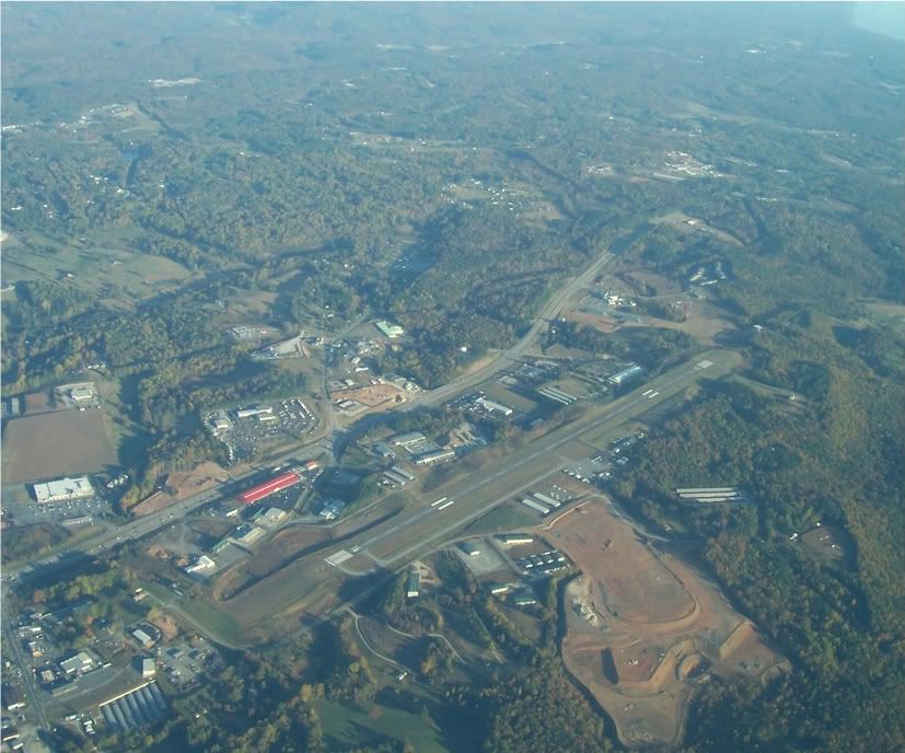
Departure from Andrews-Murphy Airport, Murphy, NC:
Another day, another canceled flight
Getting this IFR cross country in is proving to be a daunting task. Although the weather was better than what had been forecasted (we didn't get the snow that was promised), the low ceilings stuck around just long enough to force me to scrub the flight. My planned departure was around 5pm, but with a 500-600 ft overcast and nigttime coming soon (the club does not allow IFR flight at nighttime unless the celings are over 3000' AGL...not a bad rule) I just kept an eye on things because there were signs that the weather was improving. It did eventually clear out, but by that time it was about 6:45-7pm, which would have meant a 7:30 departure for a 3-3.5 hour flight. Since I didn't relish the idea of getting home at midnight, so I called Andy and just had him push the flight back to this Thursday. The weather looks more promising (forecast calls for severe clear that day) but I'm not holding my breath!